
Introduction
Light Detection and Ranging (LiDAR) is a cutting-edge remote sensing technology that has revolutionized the field of surveying and mapping. Initially developed and commercialized in Western countries, LiDAR integrates laser ranging systems, Global Positioning Systems (GPS), and Inertial Navigation Systems (INS) to capture high-resolution three-dimensional spatial data in real time. This advanced technology provides an unprecedented means of acquiring high-temporal and high-spatial-resolution geospatial information, making it one of the most sophisticated tools in modern surveying.
Advantages of LiDAR Technology
1. Rich Data Products
LiDAR generates multiple high-precision geospatial data products, including:
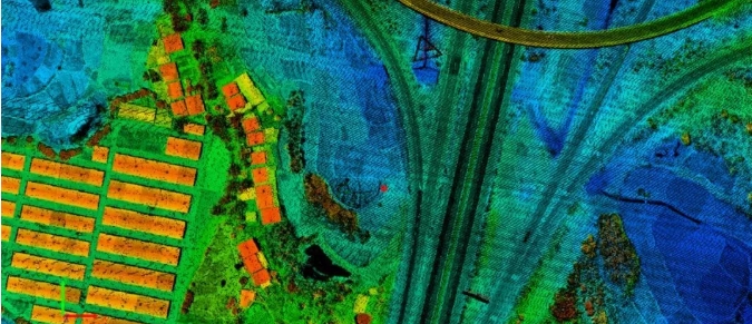
Digital Surface Model (DSM): Accurately represents terrain and surface features, enabling the production of true orthophotos and 3D models.
Digital Orthophoto Map (DOM): Created by correcting aerial images using DEM, providing measurable and interpretable visual data.
Digital Elevation Model (DEM): Extracted from LiDAR point clouds to model bare-earth terrain.
Digital Line Graph (DLG): Facilitates rapid production of large-scale topographic maps (1:500 to 1:2000), reducing fieldwork requirements.
2. High Automation
LiDAR systems automate flight planning, data acquisition, and processing, minimizing human error and ensuring comprehensive coverage.
3. High Sensitivity
LiDAR can detect fine details beyond the resolution of traditional satellite or radar imagery and penetrate vegetation to capture ground-level data.
4. All-Weather Operation
As an active sensing technology, LiDAR operates independently of sunlight, making it effective in shadowed or low-light conditions. It is less affected by weather compared to photogrammetry.
5. Short Production Cycle
LiDAR reduces the need for ground control points, accelerating DEM and DOM generation. Its efficiency surpasses traditional aerial photogrammetry by 30–50%.
Key Applications of LiDAR in Surveying and Engineering
1. Rapid DEM Generation
LiDAR point clouds provide dense, high-precision 3D coordinates, enabling quick and accurate DEM creation through automated classification and triangulation.
2. Fundamental Surveying and Mapping
LiDAR simplifies the production of DOM, DLG, and DRG by providing direct georeferenced data, eliminating the need for complex photogrammetric workflows.
3. Forestry and Environmental Monitoring
LiDAR’s ability to penetrate tree canopies allows for precise measurements of forest height, density, and ground topography, aiding in sustainable forest management.
4. Engineering Surveying
Transportation: Supports road and railway design by providing accurate DEMs for earthwork calculations.
Powerline Inspection: Measures vegetation encroachment and wire sag for maintenance planning.
Mining: Monitors stockpiles and excavation volumes efficiently.
5. Smart City Development
LiDAR enables high-resolution 3D city modeling, essential for urban planning, disaster management, and infrastructure monitoring. Its efficiency in large-area scanning makes it ideal for digital twin creation.
6. Bathymetric Surveying
Dual-wavelength LiDAR systems (e.g., green lasers for water penetration and infrared for surface measurement) allow underwater terrain mapping up to 50m depth, benefiting hydrographic and coastal studies.
7. Digital Mine Construction
LiDAR assists in modeling mines for safety assessments, resource optimization, and environmental impact analysis, helping predict and mitigate risks.
8. Utility and Pipeline Mapping
Airborne LiDAR is highly effective for power transmission line surveys and pipeline routing, offering flexibility in altitude and speed adjustments for optimal data collection.
Conclusion
LiDAR technology has emerged as a game-changer in surveying and mapping, offering unparalleled accuracy, efficiency, and versatility across diverse industries. From urban planning and forestry to underwater exploration and infrastructure management, its applications continue to expand, driving innovation in geospatial data acquisition. As LiDAR systems become more accessible and integrated with AI and machine learning, their role in shaping smart, sustainable environments will only grow stronger.
For organizations seeking to enhance their geospatial capabilities, investing in LiDAR technology is not just an option—it’s a strategic imperative for the future.


https://shorturl.fm/F0zHG